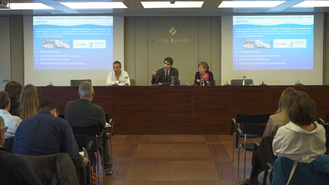
OSPAC, the new operational oceanography platform at the service of ports and cities

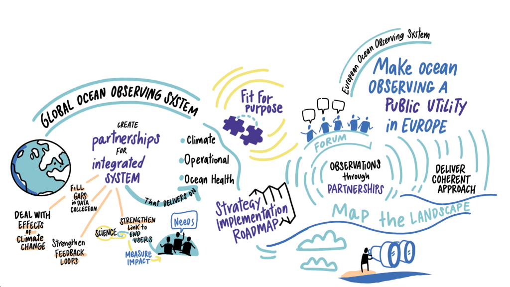
EuroSea, enhancing Europe's ocean observation and forecasting system
EuroSea is a European Union innovation action funded through the Horizon 2020 programme. The main objective is to improve the European ocean observing and forecasting system in a global context.
The key motivation is to bring the latest scientific advances and technological innovation in the field of oceanography to end-users, in order to design an ocean observation and forecasting system that is truly tailored to their needs.
"The aim is to promote the blue economy, facilitate operations and maritime safety in a context of climate change, which represents an added and important challenge," explained Begoña Pérez Gómez, Head of the Department of Port Oceanography at the Spanish Port System.
Sixteen European Union countries and fifty-five public institutions, universities and private companies are participating in the project, with funding of more than 12 million euros. "End users are also involved, helping to define the criteria and requirements of this observation and prediction system in order to develop it on a European scale," Pérez Gómez added.
The 7 objectives of EuroSea
- Integrate existing European networks for measuring ocean parameters or maritime climate variables into a global observing system.
- Improve the design of a system that integrates observations and forecasting systems over the European seas, including the coast and the open seas.
- Strengthen the availability of data and the integration of observing networks.
- Make sure FAIR (Findability, Accessibility, Interoperability, and Reuse of digital assets) conditions are met. Ensure that data are easily findable, accessible, free of charge, and easy to use by different users, both in the scientific community and in society at large.
- Providing improved predictions of oceanographic variables and products that better synthesise this information in preparation for the integration of numerical models.
- Development of novel services such as OSPAC (Oceanographic Services for Ports and Cities) to add value to ocean observation systems for end-users.
- Supporting the creation of a system tailored to ocean observing end-applications by including end-users and other stakeholders in the development of such observing systems.
OSPAC, high resolution forecasting for ports and cities
Formed by ten working groups, the fifth, called 'Coastal Resilience and Operational Services', co-led by the Spanish Port System and with partners such as the University of Cambridge, the National Oceanographic Center, Nologin Consulting, the Port of Barcelona, the port of Taranto, and the Colombian Ministry of National Defence, is responsible for developing the Oceanographic Services for Ports and Cities (OSPAC) tool.
The objective of this working group is the instrumentation and generation of new measurement systems based essentially on sea level, the integration of these data and other existing data with high resolution models in three pilot ports: Barcelona, Taranto, in Italy, and Buenaventura, in Colombia.
"Finally, the development of an operational services tool, OSPAC, to serve ports and cities, as well as the development of other innovative tools to facilitate decision-making and risk management," Pérez Gómez said.
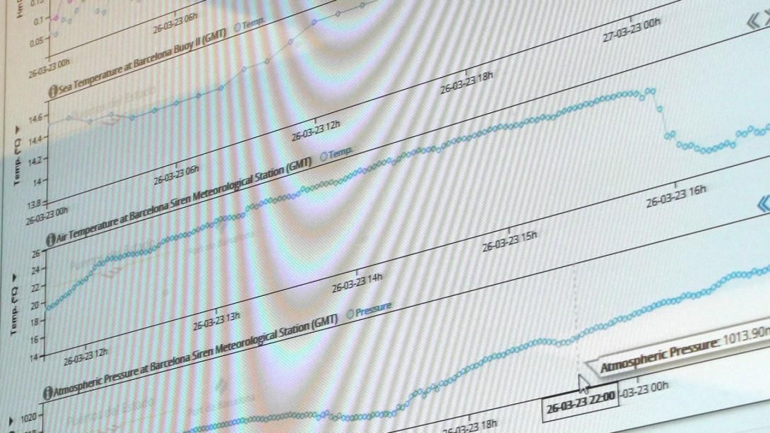
The new instrumentation under development has as its basic parameters the measurement of sea level, atmospheric pressure and the movement of the Earth. "The latter is important because sea level rise is also affected by ground movements, so it is very important to be able to monitor these two variables simultaneously," explained Pérez Gómez.
OSPAC aims to manage the coastline by integrating observations, high-resolution numerical models of the ocean, and forecasts
The 3 ports testing OSPAC
This working group employs new and innovative techniques to measure sea levels, such as the use of GNSS (Global Navigation Satellite System), a technique based on high-precision GPS that also allows sea level measurements to be obtained, in addition to vertical ground movement.
"These stations must continue to meet the requirements of accuracy and sampling frequency established at the international level. They also allow other types of sensors to be incorporated to adapt to the needs of each of the three pilots to be established in the EuroSea project," explained the Head of the Port Oceanography Department.
For example, in the case of Barcelona, a sensor will be incorporated to estimate the probability of lightning strikes, and in Taranto, the measurement of waves.
"In the case of Barcelona, the station will be located at the Bocana Norte. The main tide gauge will be installed there, together with a high-precision GNSS that will give us the vertical movement of the station. It will be complemented by a low-cost GNSS sensor that will allow us to measure the waves in this area. This station has not yet been installed, we have some administrative delay due to Brexit-related problems, but when it is installed it will be incorporated into OSPAC," she said.
The scale of the meshes used for the Barcelona pilot case and the modelling work is being carried out by the Maritime Engineering Laboratory (LIM) of the Universitat Politècnica de Catalunya (UPC).
Port-city management in high resolution
OSPAC aims to be a product that enables coastal management by integrating observations, high-resolution numerical models of the ocean and the predictions generated by these models in order to provide oceanographic services to the port and the city.
The aim is to promote environmental management, risk control and, above all, to advance the concept of smart maritime cities. "The Spanish Port System is leading this activity on the basis of the experience developed in recent years in collaboration with the ports within the SAMOA project, from which similar tools have been developed for port use," explained Begoña Pérez Gómez.
The novelty of OSPAC is that it intends to extend this concept to the city in order to favour this connection and that the city councils can benefit from these services.
"This is one of the major advances, apart from the optimisation of new modules of specific services for beaches. To develop this tool, the development of new advanced, high-resolution numerical models is essential. We are working with wave and circulation models that are nested in regional-scale operational models such as those available in the Copernicus Marine service," she continued.
These models have to be validated with in situ observations before they can be used by users. "In the case of Barcelona, we already have some models running operationally in the Spanish Port System, developed by LIM and integrated in the OSPAC tool," she said.
These models are also being developed for the port of Taranto, in this case, CMCC in Italy, who have created models nested in the regional system for the whole Mediterranean and whose data are already being integrated operationally in the Spanish Port System and in the OSPAC tool for the Italian pilot case.
How does OSPAC improve existing tools?
Begoña Pérez explained that the British partners in this working group have developed several specific functionalities for the project.
The first is the reconstruction of the average sea level changes in the Mediterranean, for which they have used a new method to reduce the uncertainty in the detection of these changes.
"One of the fundamental problems we have in the Mediterranean is that we lack information on the North African coast. This tool, which combines data from tide gauges placed along the entire coast and altimetry obtained from satellites, has made it possible to determine more accurately the evolution of mean sea level over the last few decades," she said.
Another interesting tool is a prototype for sea level visualisation and coastal planning that aims to include the uncertainty that exists in the range of variation estimated for average sea level over the next 100 years, based on the results published periodically by the Intergovernmental Panel on Climate Change.
"The idea is to develop a tool that allows the user to choose and compare the different scenarios that lie ahead, but not only that. It can also measure the economic impact of these scenarios," she added.
Pérez Gómez also indicated "that the aim is to go from a scale of 1/36 degrees in the Copernicus regional model to a scale of seventy metres on the coast and even twenty metres on the beach," he said.
Manuel Espino, Full Professor of the Department of Physical and Oceanographic Engineering at the LIM/UPC, adds that the FUAs (Functional Urban Areas) model extended to a resolution of twenty metres is very interesting because it is also a three-dimensional model that could incorporate, although it does not do so now, the outflow of tributaries due to rain or torrents as they flow onto the beaches. He pointed out that the LIM/UPC has worked with this resolution on rivers such as the Ebro, Besòs or Llobregat, but not on beaches.
What is the potential of the OSPAC tool?
The OSPAC tool consists of different modules that allow the integration of measurement stations, real-time data, 72-hour forecasts at different measurement points, also in map format, and a specific module for marine litter and spills and a system for receiving email alerts configured by the users themselves.
What is the legacy EuroSea wants to leave behind? "First of all, an improved ocean observation and forecasting system. Connecting the latest scientific advances to the end user ensures that these advances reach the operational observing system and provide easily accessible information to transform ocean information into useful information," said Manuel García-León, oceanographic services technician at Nologin Consulting.
Why do we need this tool?
"We live in a coastal zone with a very high density of use and this presents a great complexity. We have to take into account that there are other uses such as aquaculture, renewable energies, a lot of coastal infrastructure, search and rescue entities and a lot of pollution," García-León said.
Ports and cities must give a global response, but to do so, a tool that brings together different services is needed. "The observations are extremely important and I can only stress the need to continue measuring because it is the only way to have a clear reference point. How are we going to improve the models or the predictions if we don't have continuous observations?," asked García-León. Unlike observations, the problem with predictions is that they are very ephemeral and its marginal cost or benefit is limited.
By the end of 2023, the EuroSea OSPAC project should reach a TRL 7 and therefore have been successfully tested in all three pilots. A TRL (Technology Readiness Levels) measures the maturity levels of a technology and consists of 9 levels. The highest level is awarded when a system has been successfully tested in a real environment. "Right now we are at TRL 5," García-León concluded.
EuroSea project has received funding from the European Union’s Horizon 2020 research and innovation programme under grant agreement No 862626.