A plan to monitor the oceans to improve safety and sustainability
The collaboration between the EuroSea project and the Port of Barcelona has facilitated the development of observation and prediction systems for the Mediterranean Sea to prepare for the arrival of extreme events. The advances contribute to a system that seeks to improve our knowledge of the oceans at a global level.

With Gloria it all began
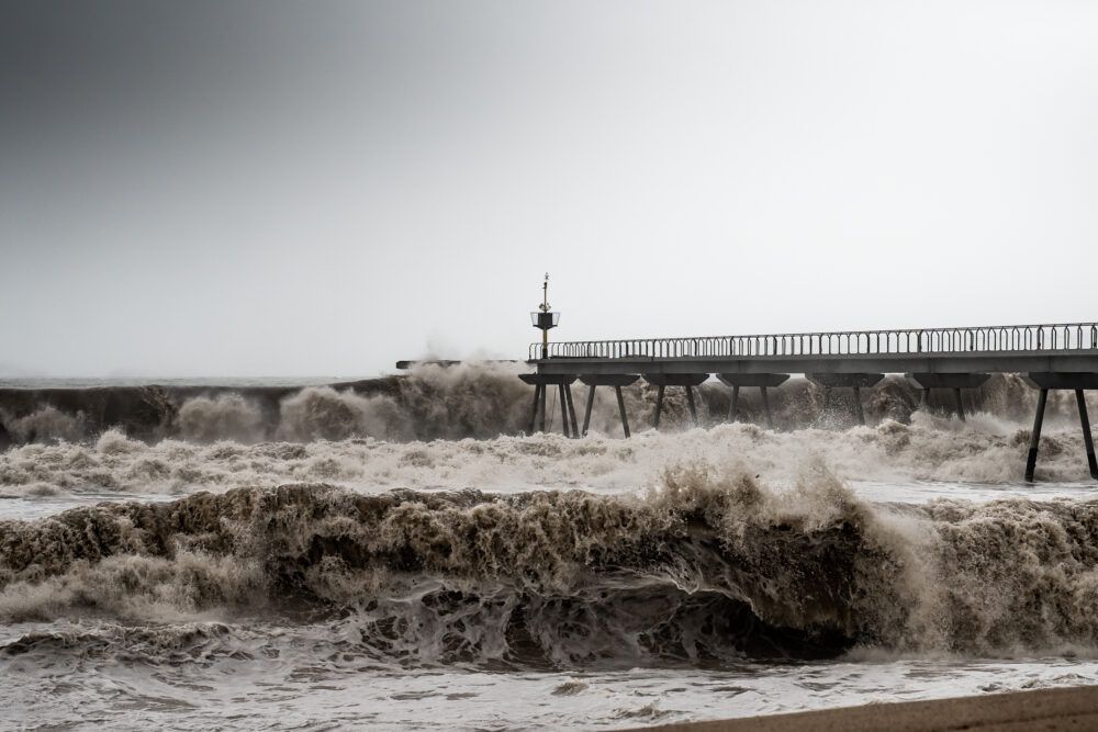
In January 2020, the Gloria squall intensified over the Iberian Peninsula, leaving significant damage in different regions, 13 dead and three people missing. Its impact was very significant on the coast of Barcelona: waves reached up to seven meters high and the force of the tides caused flooding and damage to port infrastructures and promenades, among other assets.
The magnitude of the damage left behind by storm Gloria highlighted the vulnerability of these infrastructures and coastal economic activities to extreme weather events and again drew attention to something that has been pointed out for years: the need to improve monitoring and forecasting systems to mitigate the effects of storms on the coast.
The evidence left behind by this storm also led the EuroSea team to choose Barcelona as one of the sites on which to base their research. This project, funded by the European Union, was born with the ambition to improve the ocean observation and forecasting system with a focus on European waters.
The magnitude of the damage caused by storm Gloria (2020) highlighted the vulnerability of coastal infrastructure and economic activities to extreme weather events and, therefore, the need to improve monitoring and forecasting systems to mitigate the effects of storms on the coast.
A key step towards monitoring
“If we do not monitor the ocean properly, we will not be able to predict climate and weather conditions. Nor will we be able to efficiently and sustainably manage the use of the ocean to protect it and to preserve the resources it provides us humans,” explains Dr. Toste Tanhua, senior scientist at the GEOMAR Helmholtz Centre for Ocean Research of Kiel, Germany, and a member of the team of researchers involved in the Eurosea project.
The project, completed in December 2023, involved the work of experts from organizations such as the Global Ocean Observing System (GOOS) and the World Meteorological Organization (WMO) and succeeded in improving scientific knowledge on ocean climate, marine ecosystems and their vulnerability to human impacts.
“It is fair to say that EuroSea had an impact on improving the ocean observing and forecasting system. These kinds of contributions are very important to move forward in this area,” Tanhua says.
Along with other scientific initiatives, Eurosea also contributed to the development of the European Union's Copernicus Marine Service (CMS), which provides information to support and underpin European and international ocean management policies.
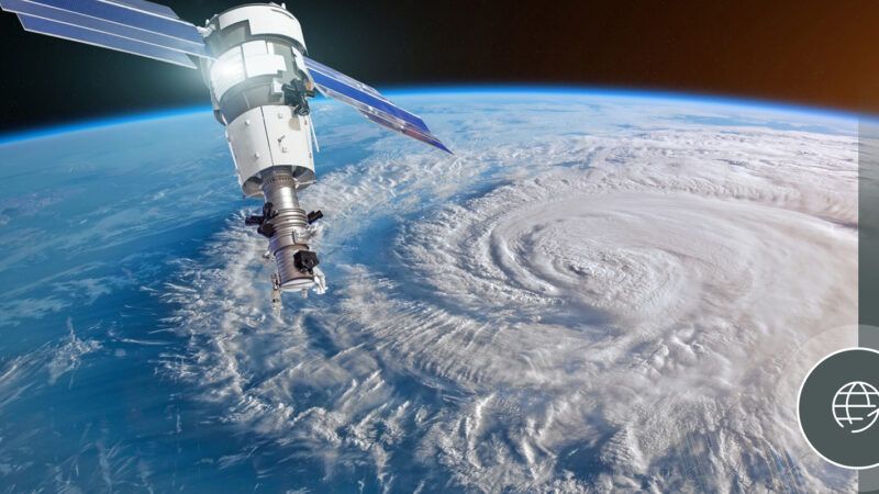
Copernicus Sentinel-1C, the third satellite of the Sentinel-1 mission, was launched last December. Data provided by the Sentinel-1 satellites are integrated into several Copernicus Marine products, providing valuable information for a variety of marine applications.
For example, Sentinel-1 radar images support oceanographic studies by providing data on wind and wave conditions. This is especially useful for weather forecasting, optimizing ship fuel consumption, developing marine renewable energy generation facilities, and understanding ocean circulation patterns. Radar's ability to pick up ocean surface features helps create accurate models of wave height and wind speed.
Sensors, data and science: the role of the Port of Barcelona
As Tanhua explains, the EuroSea project aimed to design products and services related to three areas: climate, ocean health and operational services linked to coastal resilience. “In this context, we chose to work with our partners at the Port of Barcelona to improve forecasting and monitoring activities for the port, but also for the city of Barcelona in general. This included aspects linked to currents, winds, waves, beach activities and water sports,” explains the GEOMAR scientist.
The team installed a sensor to measure currents, water level and waves in the harbor. The data it generates can be used by the scientific community to answer relevant questions, such as those related to the potential impact of storms. In addition, EuroSea developed an operational system that can be accessed at any time to know the current state of currents and waves. This allows forecasts to be made and warnings to be issued in case dangerous conditions are expected, which can determine the safety of the port, commercial activities and the population living and working in coastal areas.
These advances also leave the door open to the creation of digital twins of the ocean, capable of generating different possible scenarios. “A digital twin depends on observational data to feed the model, just as a weather forecast model depends on input data to provide accurate results. In this context, the instruments installed by EuroSea can be of great importance,” Tanhua explains.
The map of monitoring projects
Over the last few years, similar projects have been carried out all over the world. Within the framework of the EuroSea project, the Port of Barcelona, together with Puertos del Estado and Nologin Consulting, has developed OSPAC, a system for real-time monitoring of the coastline, which allows the prediction of values such as wind speed and wave height, among others. OSPAC, financed by the European Commission, is implemented, in addition to Barcelona, in Taranto, Italy, and Buenaventura, Colombia.
Also, within the framework of the United Nations Decade of Ocean Sciences for Sustainable Development, “the Coast Predict project is leading international progress to improve downscaled ocean modeling to improve conditions for coastal communities and ports,” Tanhua shares.
Among the objectives of this project are to obtain data with which to improve human interaction with the oceans, mitigate climate change, restore currently degraded habitats and promote a more sustainable blue economy.
In Spain, the Samoa-2 project is also of particular interest. The Port Authorities Meteorological and Oceanographic Support System is an initiative, developed by Puertos del Estado in collaboration with different port authorities in the country, which aims to improve the meteorological and oceanographic information systems in each port by improving high-resolution weather forecasting systems, prediction of agitation or currents or real-time alerts, among others.
The Samoa-2 project enhances the systems already developed through Samoa, a previous initiative. Among the Port Authorities participating in the Samoa-2 project is that of Barcelona, with the aim of improving its real-time early warnings based on instrumentation and integrated into the CMA (the Environmental Command Center, a platform for viewing weather forecasts and monitoring in real time, in a Geographic Information Systems environment), operational forecasting by zones and the measurement campaign inside the port.
Ocean observation is big science and cannot be implemented by individual nations alone, say the experts, who call for ensuring high-level integration for coordinated ocean observation that can be sustained over the long term.
In addition to these state initiatives, there is the goal of having an international system based on collaboration and capable of integrating data from all points on the planet. “We still have fundamental gaps in our ocean observing and forecasting capabilities. These gaps limit our ability to sustainably manage our activities and sustain ocean resources,” they note in the EuroSea legacy report, ‘EuroSea legacy report: Improving and Integrating the European Ocean Observing and Forecasting System’.
“Ocean observation is big science and simply cannot be implemented by individual nations alone. We urgently need to ensure high-level integration for coordinated ocean observation that can be sustained over the long term,” add the report's authors. Only then will we have the data and forecasts to advance scientific knowledge, increase resilience to extreme weather events (increasingly frequent and dangerous due to climate change) and raise awareness of the need to protect the oceans.


